



Trail Start
Park in the back left corner of the Marketplace Mall, in the parking lot closest to Hamrick’s department store. The entrance is marked by a sign with a map, two rocks and a yellow metal pole.

Washington Park
You’ll arrive at Washington Park. As you approach the fence for the baseball field, keep left and then keep left again to go across the foot bridge over Salem Creek. Just after the footbridge, keep to the right (going to the other direction after the bridge will take you to the Upper Parking Lot for Washington Park).

Gateway Nature Preserve
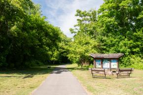
After passing a dog park and a baseball field on your left, stop to read the interpretive signs welcoming you to the Gateway Nature Preserve. The Preserve is a 19-acre area between Washington Park and Broad Street. Less than one-tenth of a mile after the sign, you’ll see a signed entrance for Forest Discovery Trail on your left.
Broad Street + Bridge
At the fork here, take the pathway to the right that goes under the bridge. Staying to the left will take you to Broad Street (although, if you miss this turn, the path will link back up to the Salem Creek Greenway in about a tenth of a mile).
Downtown Views
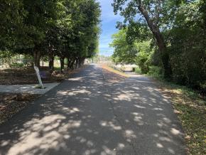
Stop to enjoy the long-range views of downtown Winston-Salem, including the domed Wells Fargo building that towers in the distance.

Molly Leight's Crossing Bridge
Head over the Molly Leight’s Crossing, an architecturally stunning wooden arch bridge. The crossing is named in honor of former Winston-Salem City Council Member Molly Leight, who represented South Ward from 2005-2016. Just after the bridge, you’ll see the YWCA building.
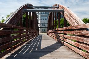
Main + Waughtown Streets
When you reach the road (intersection of Main Street and Waughtown), turn left to stay on the sidewalk rather than crossing the street. This next section of the trail includes the most turns you’ll encounter along the way and is the one stretch during which you’ll want to pay extra attention to make sure you’re staying on track. Up the street is a traffic circle area that will come into view.

Salem Creek Bridge
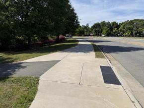
Just after crossing over Salem Creek on the sidewalk, you’ll see a paved pathway on your left that heads down under a pair of bridges (under South Main Street). Take this path.
Tennis Courts
Once you cross under the second bridge, you’ll emerge at the Central Park Tennis Courts. Stay to the left back toward Main Street (staying straight on the pathway takes you into the Central Park parking lot).

Historical Marker
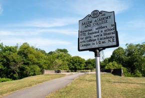
As you come around the bend, keep left, passing a Salem Academy and College historical marker. Go through the small plaza marked by yellow metal stanchions and benches on raised concrete on either side.
Happy Hill Neighborhood
Keep left at the trail junction to enter Happy Hill, marked by an interpretive sign. The area is the city’s oldest historically Black neighborhood. Happy Hill was originally known as ‘Liberia’ and was founded in 1872 as a place where formerly enslaved people and freedmen could purchase land. Staying straight at this trail intersection will take you to Alder Street and Waughtown Street near the campus of the University of North Carolina School of the Arts.

Park + Playground
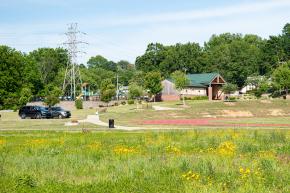
In the midst of a long straightaway with open grassy areas and a meadow, you’ll see the pathway to Happy Hill Park on your right. There is a track, playground and restroom facilities here. Keep walking straight to cross a small footbridge and continue on the Greenway.
Wade Bitting Bridge
At the four-way intersection, keep straight. Turning left takes you across the Wade Bitting Bridge, which honors an early advocate for the Happy Hill Community. Turning right takes you to Liberia Street.

Long Branch Trail Connection
Just after crossing under the Research Parkway Bridge, you’ll notice an unmarked paved path to your right. This path leads to the Long Branch Trail, a 1.7-mile urban walking trail through the heart of downtown Winston-Salem.
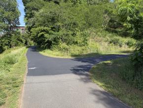
WSSU
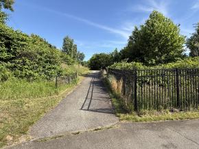
After crossing first under a metal bridge, and then a concrete bridge under US Highway 52, you’ll come to a third bridge. This bridge goes under Rams Common Drive. This area is home to Winston-Salem State University. Go under the bridge to continue on the Greenway. The pathway just before the bridge to the right (marked by a black metal fence) will take you up to the road and the university area.
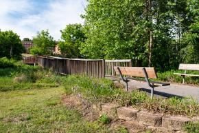
Civitan Park
On your left, you will notice a bridge over a marshy area. This is Civitan Park, a greenspace and another access point to Winston-Salem State University.
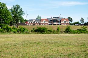
Bowman Gray Stadium
You’ll reach a large open field area on your right. In the distance, you’re seeing the back of the Albert H. Anderson Jr. Conference Center on the Winston-Salem State University campus, as well as Bowman Gray Stadium in the distance on the other side of the path.
Peachtree Greenway + Waughtown Connector
The trail intersects with the Peachtree Greenway on your right. This intersection is marked by two large power stations. The Peachtree Greenway will eventually lead you to the Waughtown Connector Trail and The Quarry at Grant Park, a popular park and community gathering place that acts as a great connector along the greater greenway system. Connect in for skyline views, restrooms, and a unique playground for your littles!
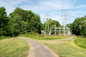
Reynolds Park
On your right, you'll pass the entrance to Reynolds Park. There are public restrooms at the park as well as other park amenities such as athletic courts, picnic shelters, splashpads and play equipment, and a full-sized municipal golf course.
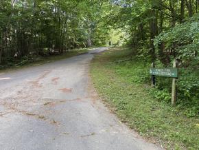
Reynolds Park Golf Course
Fore! Pause to take a moment to admire the rolling hills of Reynolds Park Golf Course and see if you can spot a golfer in action.
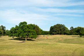
Scenic Trail Wandering
You are now entering one of the most scenic stretches of the trail! This area will have you feeling like you're weaving through an enchanted forest, with parts of the path running level with the creek.
In the next quarter mile are two dips in the trail that almost always have some water on them. Most of the time, you can walk through without getting your feet wet but after periods of heavy rain, take care and attention when passing through this stretch.

Salem Lake Trail Intersection
The trail intersects with the loop trail that goes around Salem Lake, the city’s outdoor recreation gem. Keep left to finish out the Salem Creek Greenway.
Turn right and go over the bridge to hop on the Salem Lake Loop Trail and reach the lake’s Marina shop and parking area. Many would consider this the end of the Salem Creek Greenway, however signage posted shows the Greenway technically continuing from here.

End of Trail
This stretch could be considered both the Salem Creek Greenway and the Salem Lake Loop. At the trail intersection, keep left to reach the New Greensboro Road parking area. Veer right to take the loop around the lake.
The loop around the lake is 7 miles and is a great way to extend your adventure, especially if you’re on two wheels.
